
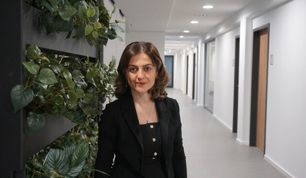
© BIFOLD
“Berlin has established itself as one of Europe's leading AI hubs.“
Prof. Dr. Begüm Demir, Deputy Director of BIFOLD
InterviewShare on:
Every day, the Sentinel satellites of the European Copernicus programme orbit the Earth, collecting about 20 terabytes of data – on forests, cities, climate change, and natural disasters. Yet these vast amounts of data have so far remained the domain of experts. Prof. Dr. Begüm Demir of TU Berlin and BIFOLD wants to change that: with her project "Agent-BigEarth", she is developing an AI agent that makes satellite data accessible via simple language queries or images – for journalists, policymakers, or curious citizens.
For this vision, Demir has just received one of the coveted ERC Proof of Concept Grants – a funding instrument designed to translate pioneering research into practice. In this interview, the Professor of Remote Sensing Image Analysis explains how Agent- BigEarth works, why Berlin is an ideal location for this kind of AI research, and what it would mean for Europe to set the global standard in AI-powered environmental information.
In addition, she offers a first glimpse into the topics that will be explored during the „Agentic AI for Earth Observation“ workshop, which she is co-organizing with ESA this autumn in Berlin. The workshop is open not only to researchers but explicitly also to practitioners, companies, and startups.
Prof. Demir, with the BigEarth project you laid the foundations for AI-driven analysis of satellite data. Now comes Agent-BigEarth, which aims to make this technology accessible far beyond the research community. What is the key innovation behind the new project?
Recent advances in satellite technology have enabled frequent, high-resolution monitoring of the Earth at a global scale, generating unprecedented volumes of Earth observation (EO) data. Through Europe’s Copernicus programme (which is the European flagship satellite initiative in EO), Sentinel satellites generate roughly 20 TB of data every day. Copernicus data and applications are part of the European Data Economy and its value chains, since the “big EO data” is a great source for information discovery and extraction for Earth observation. When we started the BigEarth project in 2018, our objective was to design and develop accurate and scalable AI models for satellite image understanding, search and retrieval from massive EO data archives. These models provide the scientific foundations for knowledge discovery systems that can efficiently index and query the content of data from continuously growing EO archives.
Agent-BigEarth is the natural next step. For the first time, we are integrating these research advances into a practical, AI-powered assistant that aims at changing how people interact with Copernicus data. Rather than asking users to learn how to navigate complex satellite data archives, Agent-BigEarth will understand the user's intent and guide them to the information they need. The key innovation lies in the combination of three capabilities: 1) Seamless, natural-language interaction with Copernicus archives; 2) Intelligent guidance that helps users find the satellite data they are looking for; and 3) Automated analysis of complex satellite images to answer specific environmental questions.
In practice, this means that instead of relying on specialized technical expertise, users will be able to engage in a natural dialogue with the system. They can ask questions in everyday language, upload an image, or describe the information they are looking for. Agent-BigEarth will identify the relevant satellite data, orchestrate the necessary analysis tools, and provide clear, structured answers together with the supporting satellite information. In this sense, Agent-BigEarth closes the gap between advanced AI research and the operational use of Europe's Copernicus archives. It transforms them from a resource that is primarily accessed through technical workflows into an intelligent assistant that makes environmental intelligence much more accessible to researchers, policymakers, journalists, and citizens. It marks a paradigm shift in autonomous environmental intelligence and helps to maximize the societal value of Europe's investments in Earth observation.
Copernicus – the European Earth observation programme – produces 20 terabytes of data every day. Until now, only specialists could work with it. Can you walk us through a concrete example of what Agent BigEarth makes possible – what could a journalist or a mayor actually ask, and what would the agent show them?
One of the biggest barriers today is not that satellite data is unavailable. Accessing and interpreting it requires expertise in remote sensing, data management and machine learning. Agent-BigEarth is designed to remove much of that barrier by allowing people to interact with EO data in a much more intuitive way. For example, let us consider a journalist. Instead of downloading satellite images and learning how to process them, they could ask, "How has this area changed over the last ten years?" or "Has deforestation accelerated in this region?" Agent-BigEarth would identify the relevant satellite observations, analyze them, and present the results in a way that is easy to understand, together with visual evidence and an explanation of how the conclusion was reached. A mayor or urban planner might ask, "Which parts of our city have experienced the strongest urban expansion?" or “Where are green spaces declining?”
The agent could combine observations from different Sentinel satellites, generate maps that highlight the detected changes, and summarize the trends over time. This could support evidence-based planning and decision-making. The key innovation is that users no longer need to know which satellite collected the data, which sensor to use, or which processing algorithm to apply. They simply express what they want to know. Agent-BigEarth takes care of orchestrating the necessary AI models and software tools behind the scenes, while also explaining the results and their limitations. Our goal is not only to make satellite data easier to access, but also to make the insights derived from it transparent and trustworthy.
Why is your idea new and original? Why does it represent a paradigm shift?
Cloud platforms like the Copernicus Data Space Ecosystem provide Copernicus data, yet access remains limited to basic keyword searches. There is a critical gap: no provider offers an AI assistant to help users query complex data content. The Agent-BigEarth, a multi-agent digital assistant powered by large-language models, enables seamless, conversational interaction, helping both experts and non-experts efficiently find and extract insights from Copernicus archives. I would like to highlight that it establishes the first agentic assistant capable of modernizing access ways to the EO data that is complementary to the existing tools for keyword/tag-based search.
The innovations that are brought with Agent-BigEarth complete the missing technological piece in the online platforms where satellite images in Copernicus archives can be accessed and queried. From a societal perspective, it makes satellite data accessible to non-technical users that can address several real societal challenges (e.g., disaster response and recovery, climate change monitoring and adaptation, sustainable agriculture and food security, etc). This innovation directly supports the European Green Deal, the United Nations Sustainable Development Goals, and the EU Digital Strategy.
Why is Berlin a good place for this kind of AI research – and what does the city's ecosystem offer that matters for a project like yours?
Agent-BigEarth requires interdisciplinary expertise in remote sensing, big data management, machine learning and geospatial data analysis. BIFOLD provides a unique environment because it brings together leading expertise in these areas under one roof. This is particularly important for our project, as we are developing a multi-agent AI system that can interact with and analyze petabyte-scale Earth observation archives. Equally important are the outstanding students and early-career researchers at TU Berlin and BIFOLD. Their talent, curiosity, and interdisciplinary mindset are a major driving force behind innovation. Working with such highly motivated young researchers allows us to explore ambitious ideas and rapidly translate cutting-edge research into practical solutions.
I think that Berlin has established itself as one of Europe's leading AI hubs. The city's vibrant research ecosystem connects excellent universities, research institutes, startups, and international partners, making interdisciplinary collaboration part of everyday research. For Agent-BigEarth, this is invaluable given that addressing its challenges requires exactly this kind of collaborative environment.
You have just received the ERC Proof of Concept Grant – a funding instrument specifically designed to bring research into practice. What is the roadmap from here, and when will people actually be able to use Agent BigEarth?
The ERC Proof of Concept Grant is an exciting opportunity because it allows us to take the next step beyond fundamental research. The goal is not only to demonstrate scientific excellence, but also to show that our research can be translated into a practical technology with real societal value. The project has recently started in June last month, and we have 18 months to complete it. We currently focus on its development and evaluation. This involves integrating the AI components that can understand users' requests, identify the appropriate data analysis tools, and generate reliable and transparent answers.
An equally important part of the project is evaluating the system with potential users to understand how people interact with it and how we can make it both intuitive and trustworthy. The Proof of Concept phase is also about assessing the pathway to impact. We will explore how it could be deployed, who the key users and partners are, and what is needed to turn a research prototype into a robust and sustainable solution.
If Agent BigEarth were fully up and running – local media checking flood risks, NGOs monitoring deforestation, school classes exploring their city – what becomes possible that isn't possible today?
The Copernicus programme provides an extraordinary public resource, but for most people it remains out of reach because working with satellite data requires specialized knowledge, software, and significant time. If Agent-BigEarth is successful, it could fundamentally change that. Imagine a local journalist investigating flood risks. Instead of relying solely on existing reports, they could directly ask how flood-prone areas have changed over the past decade and receive satellite-based evidence together with an explanation of the results.
An environmental NGO could monitor changes in forests or wetlands without having to build its own remote sensing expertise. Teachers could invite students to explore how their city has grown, how green spaces have changed, or how drought has affected the surrounding landscape, all through natural interaction with EO data. More broadly, I think that this will democratize access to environmental information by transforming the Copernicus archive from a static repository into an actionable knowledge base.
What more does Europe need to do to become a global leader in AI-powered environmental intelligence?
Europe has a unique opportunity because it already possesses two extraordinary assets: 1) the Copernicus programme that provides an unprecedented wealth of satellite data as a public resource; and 2) outstanding research community in AI and remote sensing. The next step is to combine these strengths and translate them into technologies that people can use. To achieve this, we need sustained investment both in: 1) fundamental AI for Earth observation research; and 2) turning research results into robust, user-oriented solutions. We also need stronger collaboration between academia, space agencies, industry, and the communities that will ultimately use these technologies.
As a concrete step in this direction, we are organizing the workshop Agentic AI for Earth Observation together with the European Space Agency's Φ-lab, which will take place in Berlin from October 19–21, 2026. The workshop will bring together leading researchers and practitioners to advance collaboration and shape the future of Agentic AI for Earth observation. Further details regarding the event can be found on our workshop website: https://agentic-eo.berlin.
Thank you for the great conversation.
Vita: Prof. Dr. Begüm Demir is one of the deputy directors of BIFOLD – the Berlin Institute for the Foundations of Learning and Data. She holds the Chair of Remote Sensing Image Analysis at TU Berlin and leads the research group ‘Big Data Analytics for Earth Observation’ at BIFOLD. Her work focuses on the design and development of AI models for the analysis of large-scale Earth observation data. In 2018, she received a Starting Grant from the European Research Council (ERC) for her project "BigEarth: Accurate and Scalable Processing of Big Data in Earth Observation" as well as the prestigious `2018 Early Career Award` by the IEEE Geoscience and Remote Sensing Society for her research contributions in machine learning for information retrieval in remote sensing. She is an IEEE Senior Member and Fellow of European Lab for Learning and Intelligent Systems (ELLIS). In 2026, she has been awarded the Proof of Concept Grant from the ERC for her project "Agent BigEarth: An AI Agent to Support Environmental Intelligence by Interacting with Copernicus Earth Observation Data“.


